IBC 2017: Vizrt partners with Google Maps for latest Viz World app
At the 2017 IBC Show, Vizrt (stand 7.A20), unveils the latest version of its popular Viz World application that now includes an integration with Google Maps. Now journalists, producers and graphic artists have the highest quality satellite imagery available to them within their editorial tools. The imagery is accessed and used in a variety of ways and improves viewer retention and ratings by helping to streamline the creation of local and world maps and other geographic-related imagery. It is available in a server/client workflow or as a standalone version.
 Thanks to a new partnership with Google, Vizrt has integrated Google Maps as an image layer in Viz World. Considering that Google has data centers located throughout the world, loading a new image is fast and easy. For users it means better maps, created quicker and with more flexibility than Viz World users, and users of the standalone Viz World Classic, have ever experienced before.
“When artists design their maps, they design them with the Google Maps layer stack already in place, so you have full access to beautiful real-time images that can be delivered on any platform,” says Petter Ole Jakobsen, CTO at Vizrt. “This means better imagery, in easy to use templates, at your fingertips.”
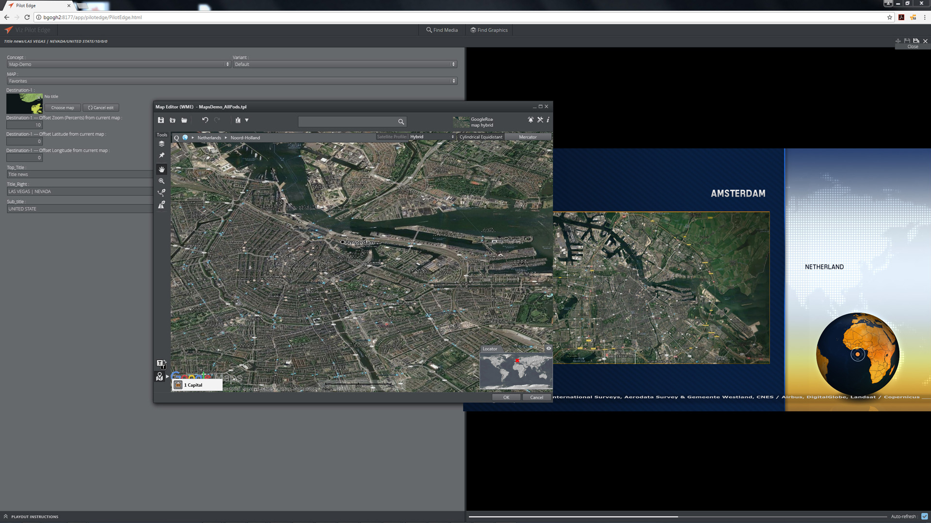
Graphic artists take their original designs and convert them into a Viz Pilot template that the journalist then can manipulate within the Viz Pilot News and Viz Pilot Edge tools that are tightly integrated with all standard newsroom systems. When the journalist pulls up a template of a map, they simply type in where they want to go, and get the highest quality satellite imagery available.
In addition, Google Maps images are automatically processed and color corrected so users can create geographic maps that feature a smooth transition from all of the different graphics tiles in a stack so that it has the ideal look every time.
Users of Viz Story, Vizrt’s social media story creation tool, will also benefit from the new integration because they can use Google Maps to make quick stories with quality looking maps to post to their social media.
“This new integration is really about providing our customers with better imagery, quicker and making these maps available for everyone that uses Viz World,” says Jakobsen. “Viewers have come to expect the highest quality images and this helps journalists tell their stories in a more detailed visual way.”
The new Google Maps integration is available as a simple software license upgrade for existing Viz World user and as part of the latest version (.17) of Viz World software.